


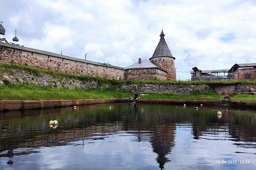
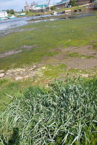
In addition to the Blagopoluchiia Bay waters, the surveys covered the adjoining land areas. In June, six sample plots were established in sites with different levels of human pressure, the composition of the flora was described, and the dominant species growing in the intertidal zone and coastal-meadow zone were identified.
A thorough study of the creeping foxtail (Alopecurus arundinaceus) growing on Bolshoi Solovetsky Island sites with varying human impact levels shows that the wellbeing of the species’ population in these habitats will be affected if human pressure grows.
- Plants in sites with heavy pollution (wastewater outlet) show signs of depression: compared with the reference (relatively clean) area, they have shorter shoots with lower biomass and shorter inflorescences, which is bad for the productivity and reproductive capacity of the population. Furthermore, they exhibited low leaf chlorophyll content, indicating photosynthetic suppression. The vitality index for the populations was also low, - explained Natalya Kaznina, Dr. of Biology, Deputy Director of IB KarRC RAS.
Scientists also continued the measurements of hydrophysical parameters, took water and sediment samples, sampled plants along the shoreline, videorecorded the coast. Stand-alone moorings were deployed in the bay to measure water temperatures, current velocities and directions through the tidal cycle.
Karelian scientists widely use high-tech methods of environmental research. Specifically, aerial surveys of Blagopoluchiia Bay and Lake Svyatoye, covering 500 000 m2, were carried out using Geoscan 401 multirotor UAV.
- Omega-48M multichannel resistivity system was used for 3D electrical resistivity imaging test surveys. A 3D geoelectrical model was constructed by sensing 8 individual shore-to-sea profiles. The electrical resistivity levels indicated by the model have helped to identify the locations of surface water discharge to the sea and the boundary of its dispersal, and to reveal the structural characteristics of the sediment body. This information provides clues for evaluating the ecological wellbeing of the Blagopoluchiia Bay sea-coast interface area and identifying areas with a contaminated surface water layer, – said Pavel Ryazantsev, Cand. Sci. in Geology and Mineralogy, Leading Researcher.
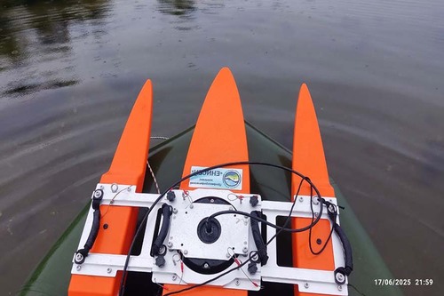
The researchers also performed trials of a new instrument – Yenisey hydrological profiler. This device yielded new data on the distribution of current velocities and directions along several cross-sections of the Blagopoluchiia Bay. Their analysis will provide information on how the tidal wave propagates through the area and how wastewater discharged into the bay head may be transported.
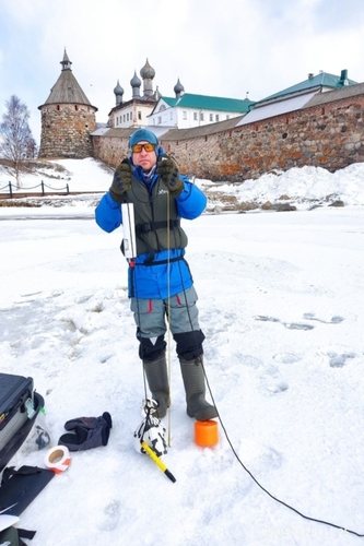
During the winter phase of the expeditions, in April, scientists measured hydrophysical parameters and studied the current state of sediments in Blagopoluchiia Bay and Lake Svyatoye.
- Firstly, we re-measured the vertical profiles of temperature, salinity and oxygen at high and low water phases at stations of the grid formed in 2024 and deployed moorings to measure these parameters in Blagopoluchiia Bay. This is necessary because only regular long-term observations can provide reliable information on the formation of the thermal and gas regimes, which govern all the subsequent processes of matter transfer and transformation inside the bay, – explained Director of the Northern Water Problems Institute, Dr. of Biology Yulia Lukina.
Investigation of the spatial variability of the ice cover revealed curious factors regarding unusual structure of the ice. There was a 60 cm thick layer of ice on top, underlain by a meter-thick layer of water, and another ice layer underneath. Such an atypical ice cover structure, coupled with high wastewater turbidity, may hinder solar radiation penetration through ice and affect the planktic community.
- The ice cover modifies the bay’s hydrodynamics notably – during the open water season, we were unable to identify the wastewater plume, whereas in the presence of the ice cover, which isolates the water column from atmospheric effects, this became possible. We established that wastewater from the Village of Solovetsky spreads through the bay within the sub-ice layer, becoming diluted during the incoming tide due to mixing with clean seawater, - noted Leading Researcher of the Hydrophysics Laboratory Galina Zdorovennova.
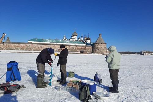
To assess the pollution of sediments in Blagopoluchiia Bay with organic matter, nutrients, and heavy metals during the winter period, top-core sediment samples were collected at 25 stations. Additionally, a 35-cm-long sediment core was retrieved near the wastewater the Solovetsky wastewater outlet. Its geochronological analysis will help date the sediments, determine the sedimentation rate, and investigate the sediment pollution dynamics.
- A preliminary finding of the winter survey is that the contamination of sediments with organic matter and nutrients is the most intensive in the bay head – in the small vessels mooring area. The accumulation of pollutants at the wastewater outlet is minor due to tides, - shared Leading Researcher of the Sediment Research Group Natalya Belkina.
The upcoming expedition to Blagopoluchiia Bay, scheduled for August, will conclude the 2025 fieldwork cycle and aims to address the following tasks: examining the mixing regime taking into account tidal effects; investigating priority pollutants and the degree of human impact on the marine ecosystem; studying the nutrient content and biological indicators to assess the trophic status of the waters; mapping the sanitary situation and performing a saprobiological assessment of Blagopoluchiia Bay's water quality.
- We will now need to do a lot of analytical work to comprehend the environment formation process in this part of the White Sea. We are also exploring opportunities for monitoring of Blagopoluchiia Bay using remote sensing data. We’ve already gained a first experience of mapping the coastal zone. The images obtained have been uploaded to the "Coastal Zone of the Solovetsky Archipelago" geoportal, – summed up Yulia Lukina.
Photos: Northern Water Problems Institute KarRC RAS


