


– This site has an area of about 40 thousand square meters, and it is packed with artifacts: we have retrieved over 300 thousand artifacts from just 30 square meters. Full-scale excavations and comprehensive documentation of cultural remains are physically impossible here. At the same time, it is very important to obtain information from the whole territory, and do it in a non-destructive way, - explained Alexei Tarasov, Head of the Archaeology Section of the Institute of Linguistics, Literature and History of the Karelian Research Centre RAS.
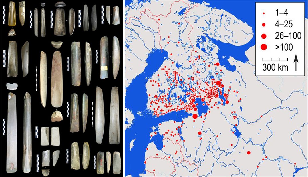
Chopping tools of the Russian-Karelian type and their distribution map
What makes the task even more pressing, the archaeologist says, is that the site is actually located within farmland. Land plowing destroys parts of the ancient cultural layer and relocates the artifacts. To preserve information about the structure of the monument in its present form and to determine the most valuable areas for new excavations, scientists proposed an approach based on GPR surveying. The results of the study were published in the international journal Archaeological Prospection.
– This approach of using geophysical methods is traditional for archaeology. However, geophysics is usually aimed at finding large structures that are hidden underground but can be clearly identified from probing data. Most often, these are foundations of buildings, burial chambers, underground passages. Geophysical methods are usually used for reconnaissance, to select the optimal place for future excavations. In our study, however, the primary task was research as such - to get information about the spatial structure of the whole site in a non-destructive way, - Alexei Tarasov noted.
Another thing that distinguished the task from other similar ones was that the site was rich in small objects, including fragments of stone, pottery shards, and bones. The experience in the study of such objects is rather limited.
– The brightest examples of the application of geophysical methods in archaeology are available for historical periods with an advanced material culture. For example, buried foundations of Roman villas have been detected - such large objects with clear geometry are readily imaged in geophysical fields and can be mapped with high detail. Earlier periods, where the material culture had different manifestations, are, however, more difficult for geophysical study. There is no clear geometry in the distribution of objects and it is hard to tell whether they are man-made or natural, - said Pavel Ryazantsev, Head of the Geophysics Laboratory of the Institute of Geology KarRC RAS.
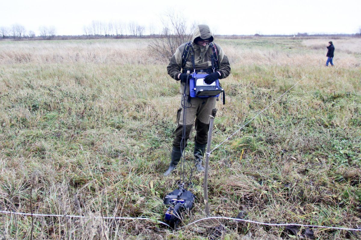
GPR surveying in process
Considering the size of the main artifacts, the researchers used a GPR antenna with an operating frequency of 1700 mHz - several times more than the sounding frequencies normally used in archaeological surveys.
Before probing in the field, the scientists did a simulation. To this end, they filled a box with sand from the Shuya River sediments, to which they added archaeological findings - flakes and fragments of stone tools found at the Fofanovo XIII workshop site previously. This approach made the laboratory model very similar to the real situation.
When doing the actual fieldwork, specialists arranged GPR profiles over the 2.2 thousand square meters of the site on a grid at 1-meter intervals and probed the soil to a depth of 73 cm. As a result, they identified dense assemblages of buried objects. To verify whether the assemblages were, in fact, artifacts associated with stone tool production rather than natural heterogeneities like pebbles and gravel, the scientists sampled the ground at 19 points with an auger. The number of findings contained in each of the extracted samples was counted – they were mostly the smallest, less than 1 cm, stone tool production wastes. The results on the density of findings in the samples coincided with the GPR results. Thus, the study confirmed that the cultural layer of the Fofanovo XIII workshop was exceptionally highly saturated with stone production wastes.
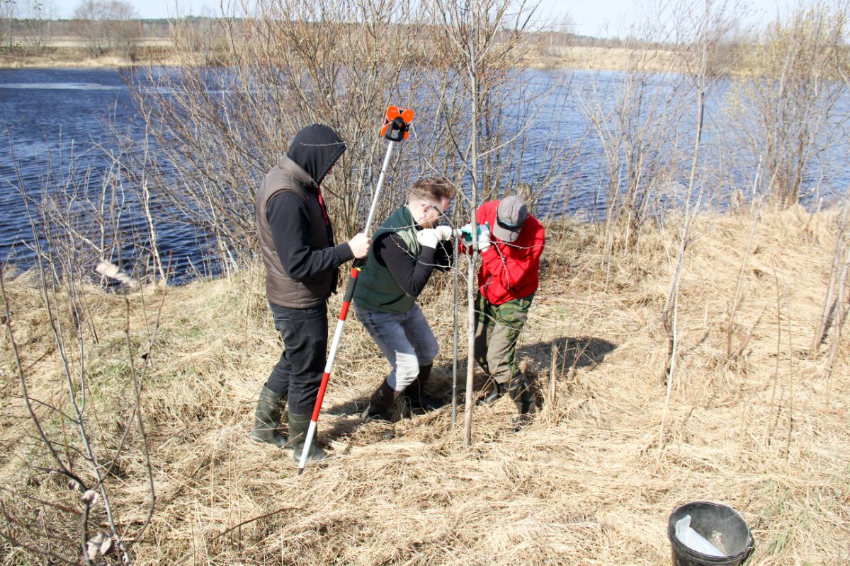
Soil sampling with an auger
The scientists have thus demonstrated: geophysical methods can be used not only for archaeological reconnaissance and finding massive objects, but also to identify assemblages of small artifacts and to detect the spatial structure of sites.
Another interesting result of the study is the discovery of the Shuya River paleobank. This is important for paleogeographic reconstruction and establishing the relationship of the archaeological site with the landscape of the corresponding time.
The study is of high methodological importance. At the same time, scientists stress that the performance of geophysical surveys is influenced by various natural factors, including soil composition and wetness, and others. That is why such studies should be carried out at different archaeological sites and in different natural conditions to determine the capabilities and limitations of the method.


